With the GeoXplorer application, educators across the world can help students study geology at all scales.
The Fossett Laboratory for Virtual Planetary Exploration appears to be a dark, unassuming room in Rudolph Hall. But, through a pair of augmented reality HoloLens headsets, the venue can transport you to Mars or the atomic world of a mineral, all while you’re conversing with your friend. Augmented reality, or AR, isn’t as immersive as virtual reality; rather the system projects a hologram in front of you, allowing you to explore a virtual space or feature while still seeing your physical environment. A few years ago, Ray Arvidson, the James S. McDonnell Distinguished Professor in the Department of Earth and Planetary Sciences (EPS), approached Phil Skemer, associate professor in EPS and director of the Fossett Lab, and asked him to try on the headset, which Arvidson had been using to program the Curiosity rover’s path on Mars. Skemer quickly realized the educational implications of this technology.
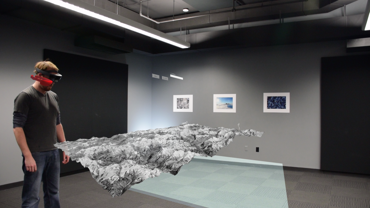
For the past year and a half, Skemer has been incorporating HoloLens technology into his teaching. He and his team have also been working to create an app called GeoXplorer, which, when combined with a HoloLens headset, allows anyone to study geologic phenomena in 3D. The app, which can be used on Windows-based computers and the Xbox One, was released on the Microsoft store back in August, and it has been downloaded a few hundred times since then.
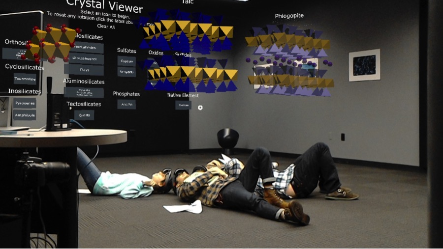
“The headset itself has cameras, which it uses to map the shape of the room,” said Skemer. “So it can digitally anchor the model at a certain position in space, relative to certain things like desks, the walls, and other things in the room.”
So far the majority of app downloads have been by research centers and universities. Martin Pratt, a research scientist in EPS working with the Lamont-Doherty Earth Observatory in New York, is hopeful that the app will be available for mobile devices soon. This should make the software even more accessible – something that the team has high hopes for, given the educational potential of the app. “The potential for AR platforms to represent complex 3D information that students can find challenging is huge,” Pratt said.
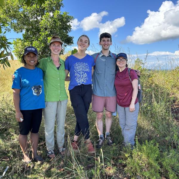
Kelsey Prissel, a PhD candidate in the department, conducted a study to examine the educational benefits of the app. As part of an EPS field class in the Azores in March 2018, she compared student interpretations of a geologic outcrop seen from a 2D image, through a HoloLens, and firsthand in the field. She found a considerable benefit to studying with the HoloLens compared to 2D images. And although the HoloLens experience was not as educational as the firsthand observations students made in the field, as the headsets’ capabilities improve and more data are added to the program, finer-scale details can be rendered within the hologram, creating an experience approaching reality, Prissel said. Although nothing can replace an actual field trip, remote ones could soon become serious options for educators.
One of the unique aspects of augmented reality is its collaborative nature. Instead of full immersion, the HoloLens headsets project a holographic view through which students can see each other. This makes the learning process a group activity that is fundamentally more interactive than textbook studying. For now, the lab has only been used for a few classes in the department, but there is hope that it will spread to other courses and even other departments. Prissel is working on building new 3D models and integrating educational components into the software. She has already implemented her own mineral structure application into a mineralogy course. “We are constantly improving our applications in response to student feedback,” said Prissel, “and I hope that in doing so, we will continue to find ways to increase the educational benefit of our applications.”
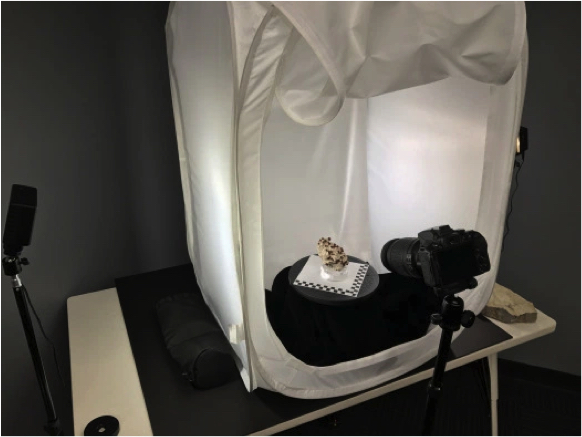
This new app has the potential to transform not only education, but research as well. If a scientist wants to study a remote geologic feature, Skemer notes they could do so within a day by just supplying the right data to be fed into the software. “We’ve built a web portal where people can donate their models to us so we upload them to be used in the program.” A rock or mineral specimen, for example, can be integrated after a few hours of slowly rotating it, taking pictures from every angle, and reconstructing a 3D shape through a process known as photogrammetry. Pratt, a seismologist, programmed all the USGS earthquake data into GeoXplorer to view zones of earthquake activity in 3D through the headsets, and he hopes more research capabilities like this will be developed in the future.
As more developments are made, GeoXplorer will become a program with immense research and educational advantages. Currently, the team is working with the Teaching Center and other researchers across WashU to understand the educational benefits of the app.
“Coupled with the options for group learning in a way that VR cannot do, I think there will be many more AR learning opportunities in the future,” said Pratt. Skemer agrees: “I think this will be the future of how this stuff gets taught.”